
Spring Military Aviation and Militaria Auction
Lot 68:
Description
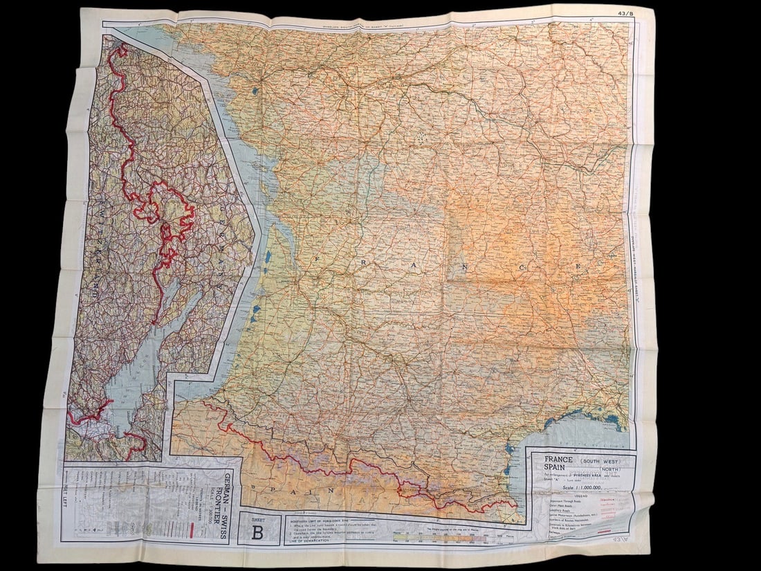
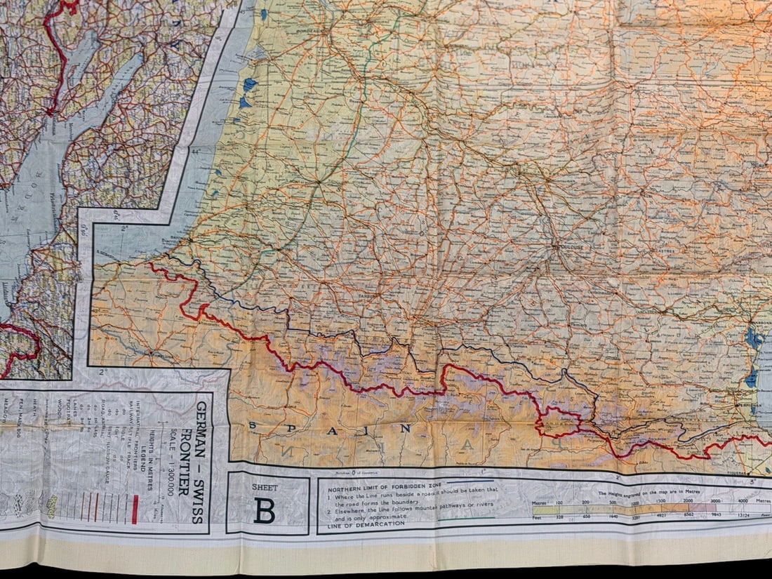
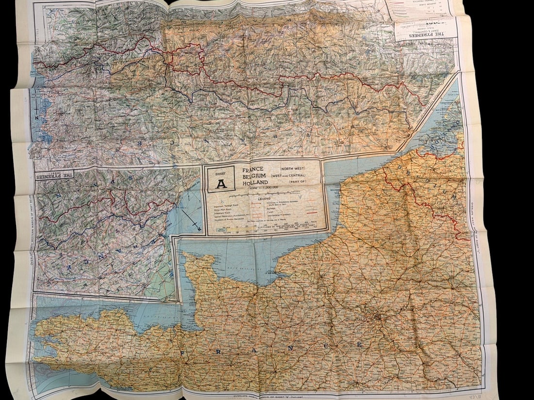
This is a double-sided World War II military escape and evasion map, designated as Sheet 43/A and 43/B. Produced by British Military Intelligence Section 9 (MI9), these maps were issued to Allied aircrews, including the Royal Air Force (RAF) and United States Army Air Forces (USAAF), operating over occupied Europe. The map is printed on a silk or acetate rayon fabric, chosen for its durability, resistance to water damage, and ability to be folded compactly and opened silently.Sheet A (North West Europe) covers Northern France, West and Central Belgium, and portions of Holland. It includes three detailed insets for the Pyrenees (East, Central, and West). Sheet B (South West Europe) covers South West France and Northern Spain, featuring a detailed inset of the German-Swiss Frontier at a 1:300,000 scale. The main maps are printed at a 1:1,000,000 scale.The cartography utilizes a multi-color printing process with red indicating major boundaries and road networks, blue for water, and shades of brown and yellow for topography. Visible markings include a legend for international frontiers, multiple and single-track railways, canals, and secondary roads. A specific box on Sheet B identifies the Northern Limit of Forbidden Zone and the Line of Demarcation, representing the division between German-occupied France and the Vichy regime territory. Corner identifiers bear the codes 43/A and 43/B.
Share this lot: