
Spring Military Aviation and Militaria Auction
Lot 74:
Description
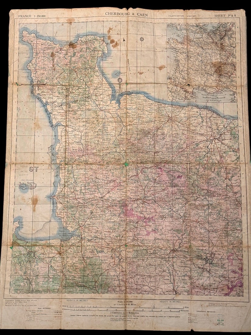
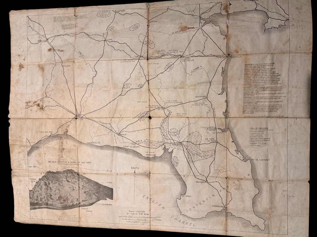
Large used combat map of Cherbourg and Caen. Folded. This is a double-sided, color-printed military topographic map of the Normandy region of France, specifically covering Cherbourg and Caen. The map is a Fourth Edition Army/Air version, identified as Sheet 3a and 8. The front side features a detailed topographic map at a scale of 1:250,000, including a coordinate grid, contour lines in meters, and detailed markings for roads, railways, and terrain features. Major cities depicted include Cherbourg, Caen, Bayeux, and Saint-Lo. The reverse side contains a monochrome Road and Terrain map of the same geographic area, specifically highlighting major routes and flooded areas. This side also includes a printed inset titled Oblique Photo of a Model of Our Area, which depicts a three-dimensional terrain model of the coastline from Grandcamp to Isigny. Printed markings in the top margins identify the map as Geographical Section, General Staff, No. 4249, published by the War Office in 1942 with a 4th Edition date of 1943. Production data indicates the map was revised by the 66th Engineer Company (Topographic) on January 15, 1944, and reproduced by the same unit on January 19, 1944.
Share this lot: