
Spring Military Aviation and Militaria Auction
Lot 70A:
Description
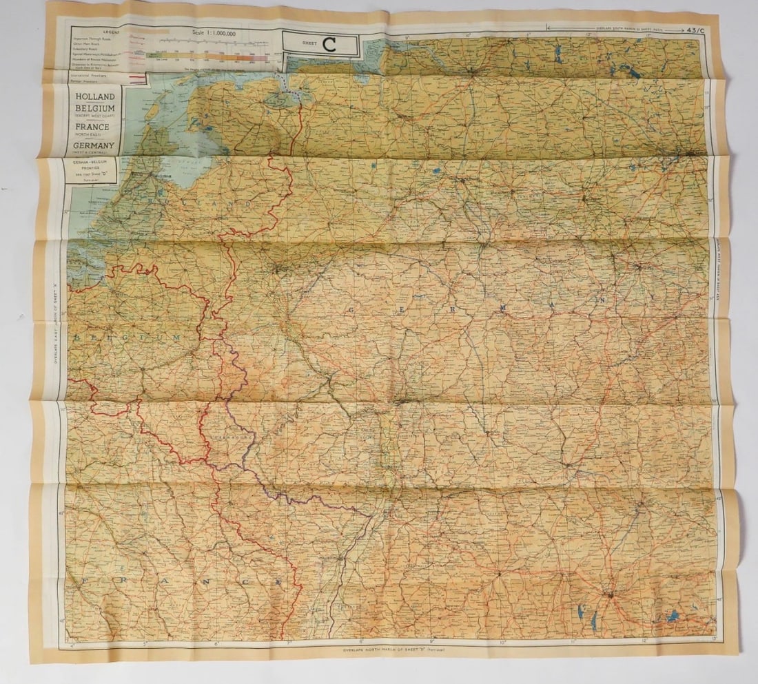
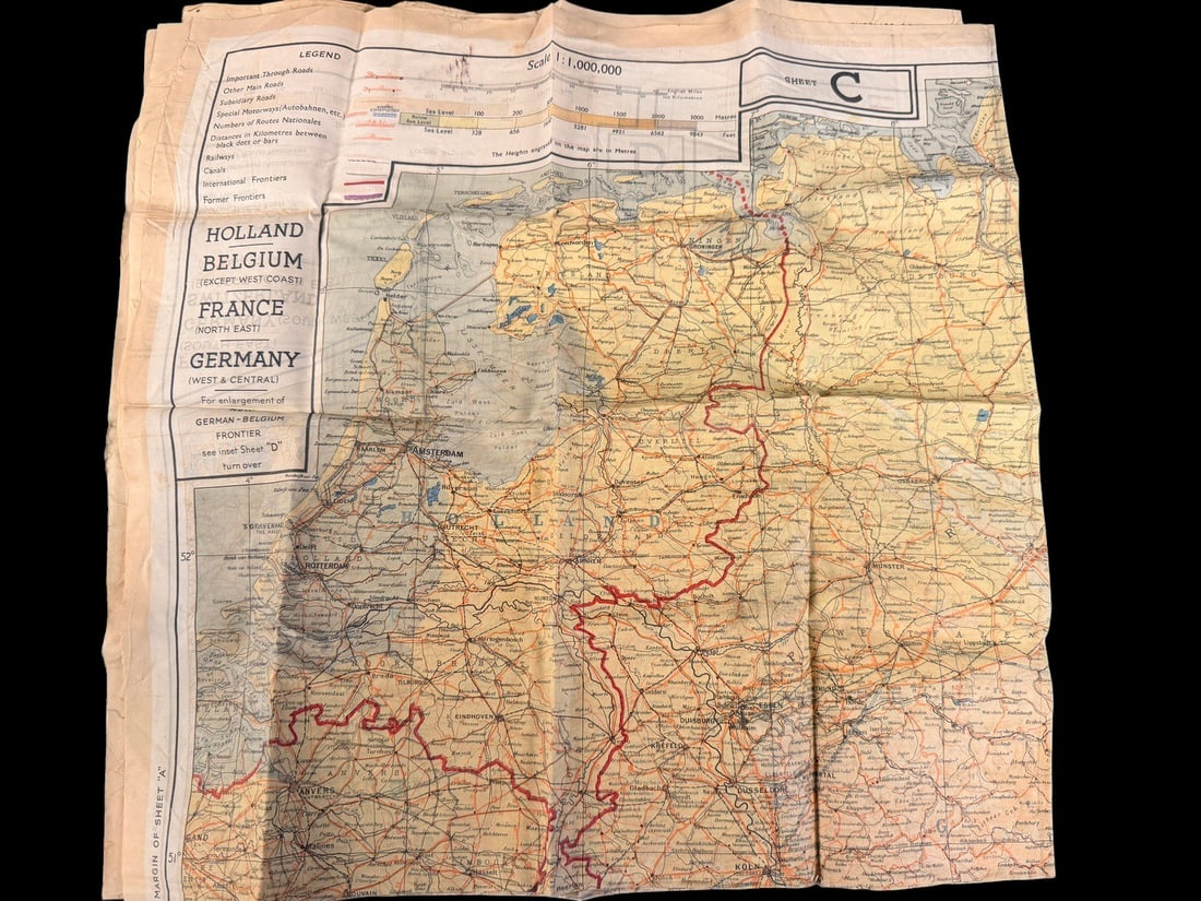
This is a double-sided escape map produced by British Military Intelligence Section 9 (MI9) during World War II, commonly issued to both British Royal Air Force and United States Army Air Forces personnel. The map is printed on lightweight rayon fabric, a material selected for its durability, water resistance, and ability to be handled silently in the field. This example belongs to Series 43 and contains Sheets C and D. Sheet C provides coverage of Holland, Belgium (except the west coast), Northeast France, and West and Central Germany at a scale of 1:1,000,000. It is marked SHEET C in the top left and 43/C in the top right. Sheet D covers Southeast France, Southwest Germany, and Switzerland (except the southeast). It includes a detailed tactical inset titled BELGIUM & GERMANY (NEW FRONTIER) at a scale of 1:250,000, which references the borders established following German annexations in 1940. Sheet D is marked SHEET D at the bottom center and 43/D in the top right. The map is accompanied by its original issue waterproof rubberized fabric pouch. The pouch features a black stenciled inscription on one side reading MAPS ONLY in block lettering.
Share this lot: